
National summer resort in Datong Township, Yilan! The Songluo National Trail is built along the stream and takes 2 hours to walk around the clock. Although the journey is long, it is easy to walk along the road. It is a common trail for both young a...
National summer resort in Datong Township, Yilan! The Songluo National Trail is built along the stream and takes 2 hours to walk around the clock. Although the journey is long, it is easy to walk along the road. It is a common trail for both young and old. It has rich and vibrant resources and can enjoy the ancient Tayya ancient times that can enjoy waterfalls, streams, rocks, mountain scenery and other scenic spots, and enjoy mountains and water.
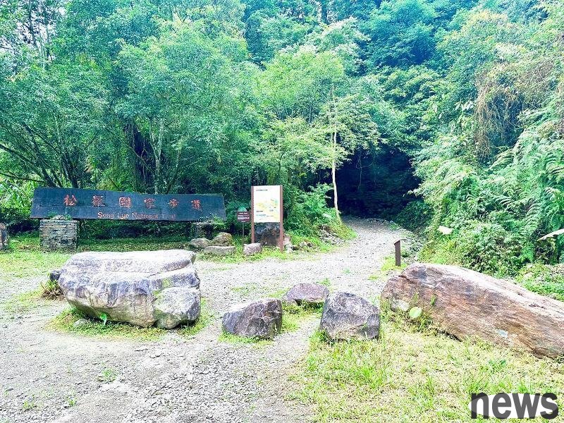
Sonro National Trail
is located in Songro Village, Datong Township, Yilan County. The Songro National Trail is along Songro Creek. The source of Songro Creek comes from the snow-capped mountains and is one of the upper reaches of Lanyang Creek. The stream water never drys up all the way. The stream water is gurgling, tide and low-altitude forests are filled with dense and tall ferns and green trees, giving birth to a rich and diverse plant ecology, creating a primitive landscape like a rainforest, and accompanying generations of Tayya people. It can be called the "Spring of Life" of the local Songro Tribe.
Songro National Trail was a way used by the Taya people in the early years to make a fortune. In order to protect this precious land, tribal residents were very dedicated from the planning, design and management of the trail. Since 2002, they launched the Shuquan movement to protect Songro Creek from excessive development and dyeing. This has also successfully nurtured the bitter fish that was once dangerous in the local area. Now, the clear water of Songro Creek often shows the fish group of fish that is connected. It is a happy trail that the tribesmen are guarding.
Detailed traffic routes◎Self-drive: Navigate the "Songro National Trail Parking Site", and walk from the parking lot to the entrance of the trail for about half an hour.
◎Public transportation
【Train + Passenger Flight】
Take Taiwan Railway to Yilan Railway Station and leave from the rear station. After leaving the station, walk along Linsen Road, then walk towards the school road, and you can reach it in about 4 minutes.
There are car and motor car (charge) parking lots around the Yilan Transfer Station, which are convenient for the public to transfer and use.
{twenty three} {twenty four}
Travelers in the northern region who want to go to Yilan can travel to Yilan at the Municipal Government Transit Station, Banqiao Transit Station, Taipei Transit Station, MRT Science and Technology Building Station, Dapinglin Transit Station, Guanshan Transit Station and Nangang Transit Station, and passengers can travel to Yilan Transit Station, Luodong Transit Station or Jiaoxi Transit Station.
1. Capital Passenger Flight
Taipei Passenger Flight
Yilan Passenger Flight
Yilan Passenger Flight
Yilan Transfer Flight
or Jiaoxi Transfer Flight
car inquiry: https://bit.ly/2VTm9n7
2. Gemalan Passenger Flight
Taipei Passenger Location: Banqiao Transit Station, Taipei Transit Station and Metz Science and Technology Building Station
Yilan Car: Yilan Transit Station, Luodong Transit Station or Jiaoxi Transit Station
car times and timetable inquiry: https://bit.ly/3lR3LWB
3. Metropolitan Passenger Transit
Taipei Transit : Dapinglin Metro Station
Yilan carriage: Luodong Transit Station, Suao
carriage, timetable inquiry: https://bit.ly/3mXE3Rl
4. Guoguang Passenger Flight
Taipei carriage: Yuanshan Metro Station, Nangang Metro Station
Yilan carriage Location: Yilan Transfer Station, Luodong Transfer Station or Jiaoxi Transfer Station
car trips and timetables: https://bit.ly/2K63LVy
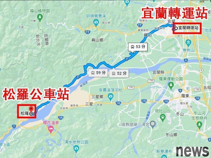
Arriving at Yilan Transfer Station, take Green 12, 1743, 1744, 1751, get off at "Songro" station, and take about 53 minutes.
{twenty three}
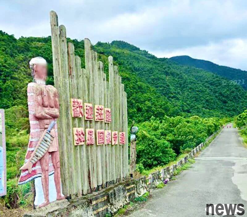
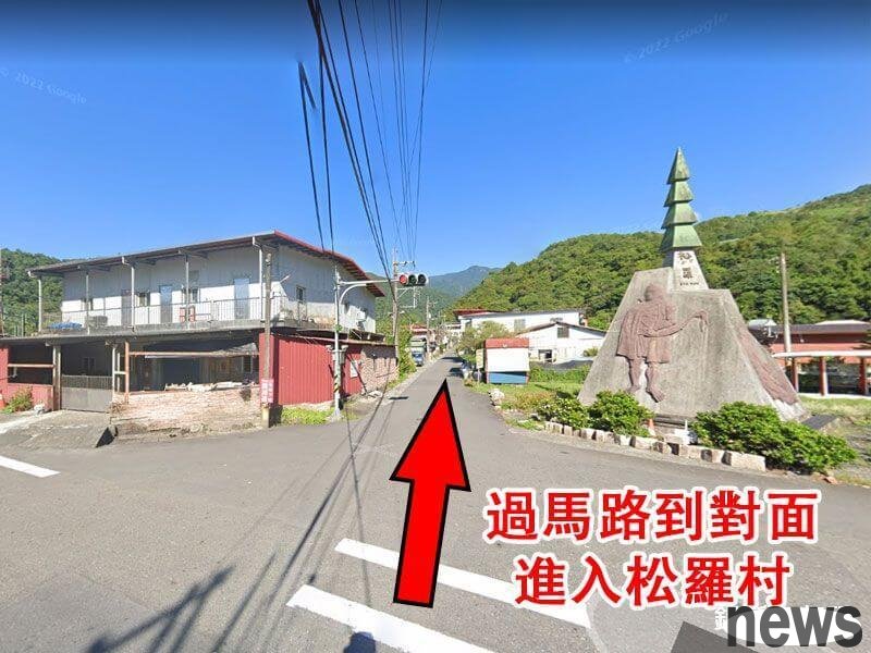
 After getting off the bus, cross the second section of Taya Road, enter the alley opposite Song Luo Village, and begin to move towards the Song Luo National Trail.
{twenty three}
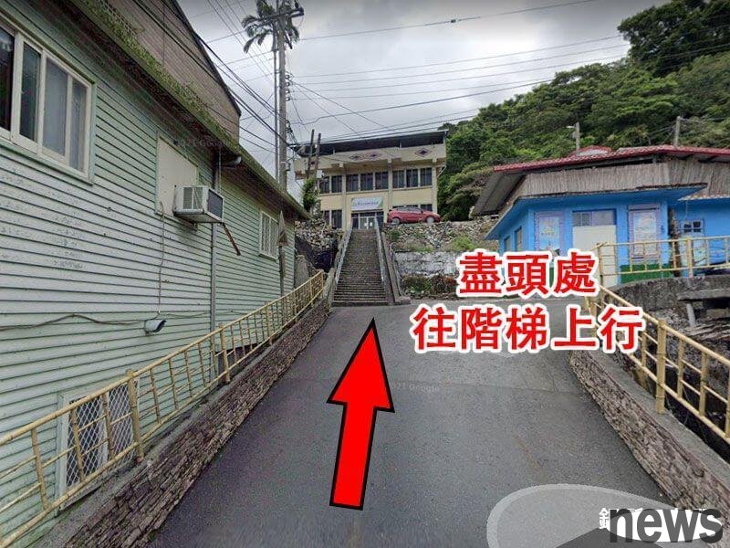
You will pass through Song Luo Village, local residential settlements, Christian churches, activity centers and Datong Primary Schools. When I walked to the end, I saw a ladder and continued to walk up.
{twenty three}
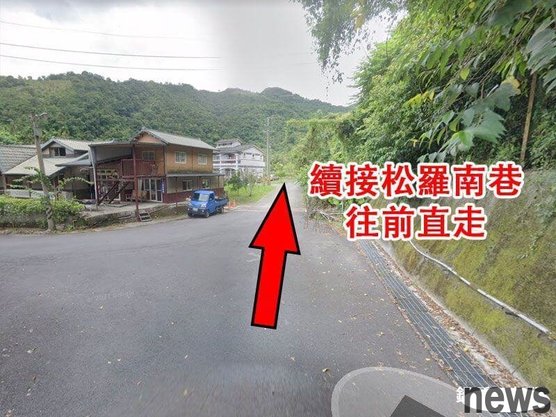
After passing the stairs, a downhill road is next, and you will walk straight forward along Songrong South Lane.
{twenty three}
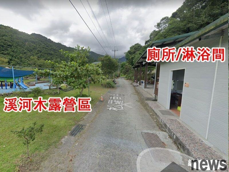
On the way, you will pass the river wood dew camp area, which is a large area of spacious and flat exposed camping sites, children's game venues, pools, barbecue areas, makeup rooms, shower rooms, parking lots and other facilities.
{twenty three}
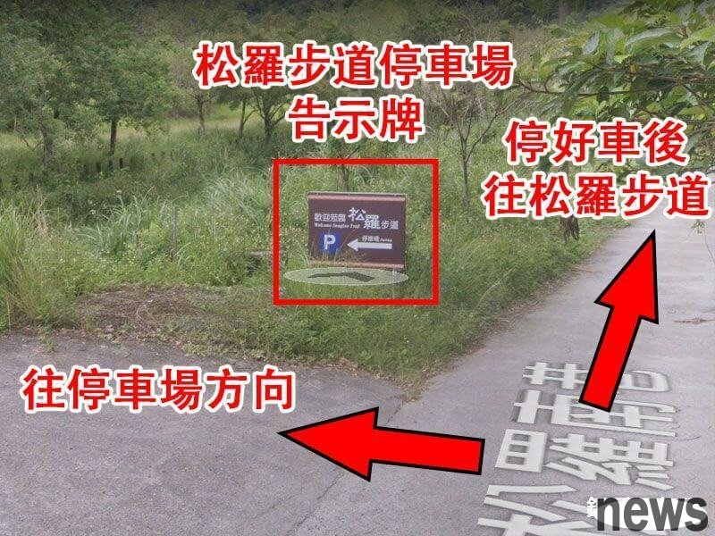
For people who drive to drive, they can park their car at the Songro Trail parking lot, park their car before walking back and moving towards the Songro Trail.
{twenty three}
Walking forward for a short distance, you will first pass the first ward, then continue walking, and then pass the other ward. If you are afraid of being in a hurry, you can go to the ward first.
{twenty three}
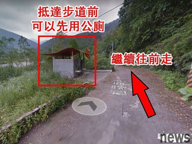
{twenty three}
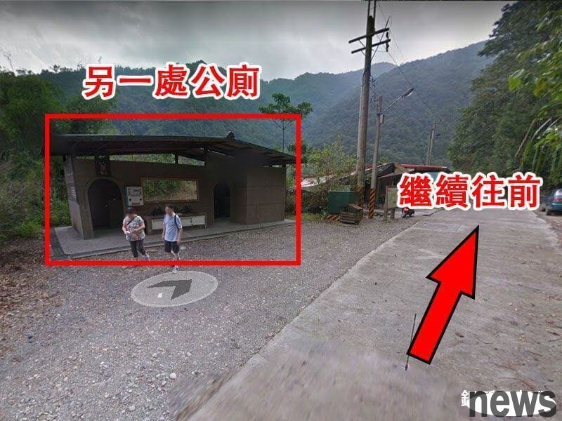
Continue to move forward, and you will pass through a water purifier on your right hand, which means that you are no longer far from the entrance to the Songro Trail. You can reach it for a short walk.
From the outermost Songro National Trail parking lot, it is about 2 kilometers away to the entrance of the trail. After the car is parked, it takes about half an hour to hike..
If you don't want to walk too far, you can park your car next to the clean water factory, but there can only be up to 8 cars here. In addition, the road is narrow, making it very difficult to drive. If you are not a person with special driving skills, it is recommended to park your car outside the trail parking lot.
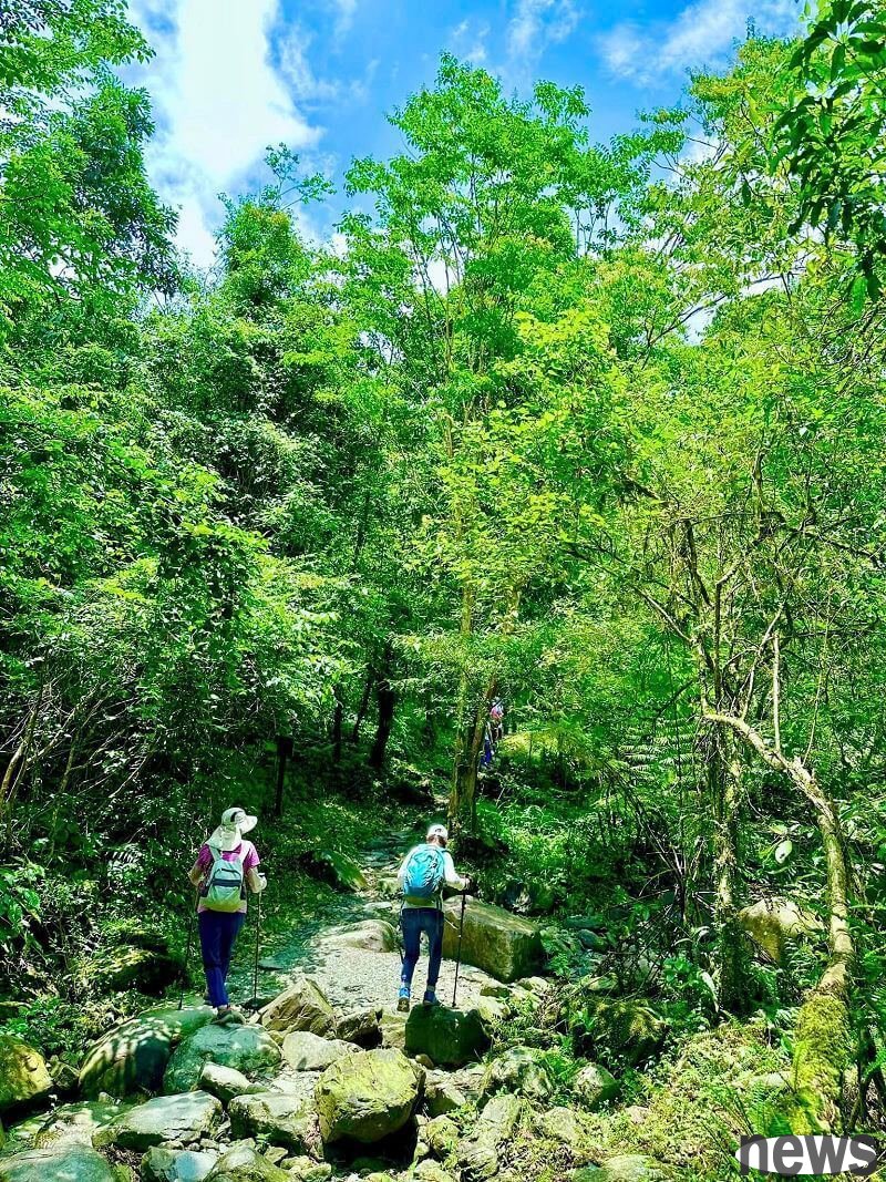
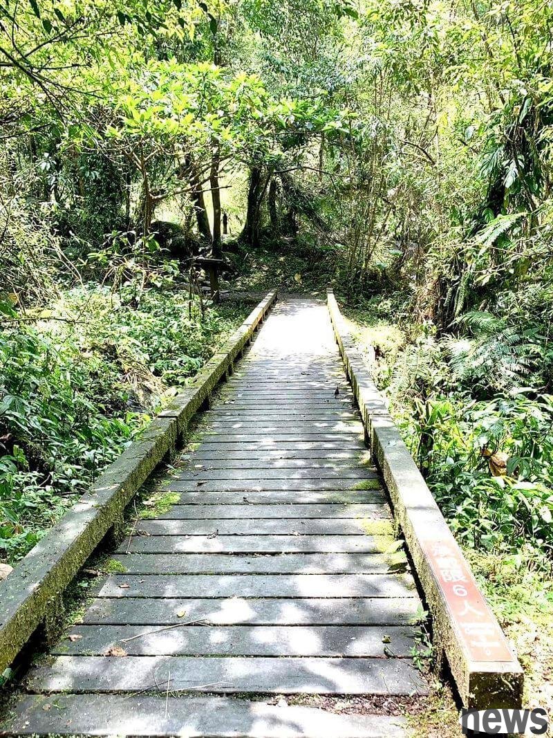
Road informationWhether you depart from a bus stop sign or parking to the entrance of the trail, or walking on the Songro National Trail, you will be very flat along the road.
The asphalt road and gravel road intersect, are simple trails suitable for all ages. The disadvantage is that the distance is longer. Please estimate the 2.5 to 3 hours of catching it when you come back.
Seat informationThere are huge rocks on the trail and the streamside to sit down and rest.
Floor InformationBefore arriving at the entrance of the Dasongro National Trail, there are at least three floors, one of which is located in the Luguan area.
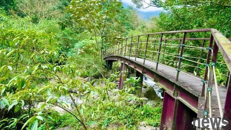
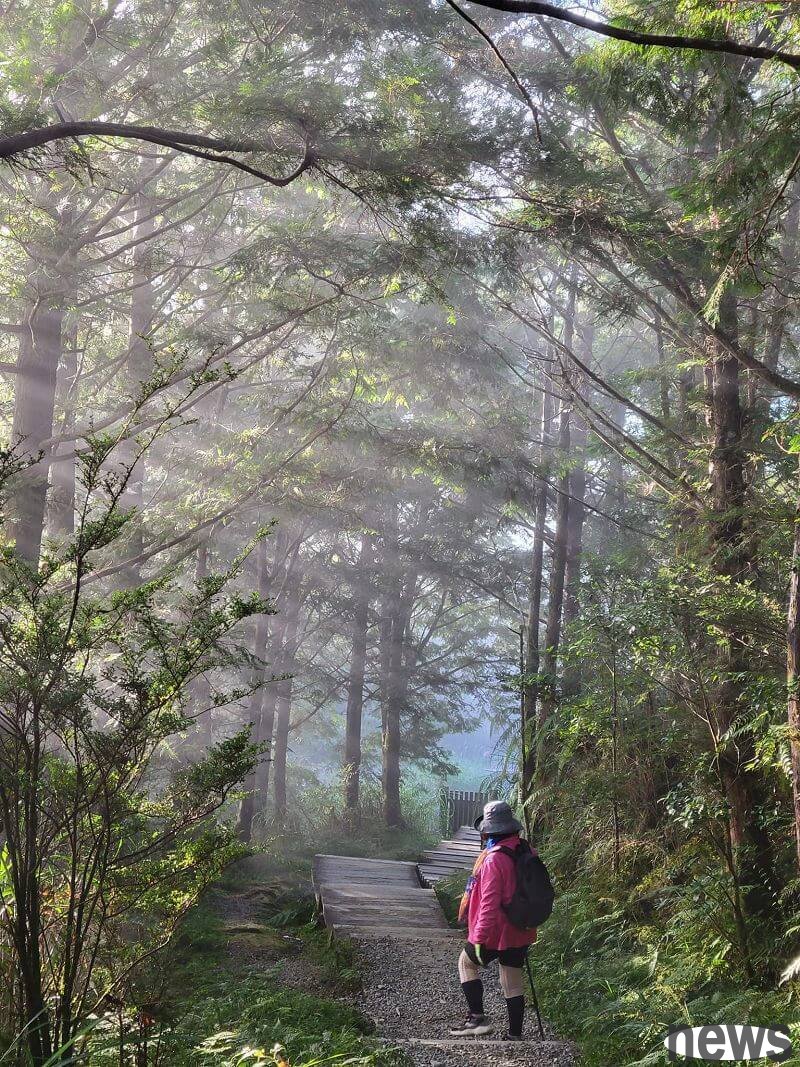
Scenic FeaturesThe Songro National Trail is located at an altitude of about 280 to 400 meters. The former Tayya tribe has been renovated into a trail built beside the stream. It is surrounded by mountains and water, and is also dependent on the warm climate, creating a rich life that is rarely seen in other trails in Yilan.
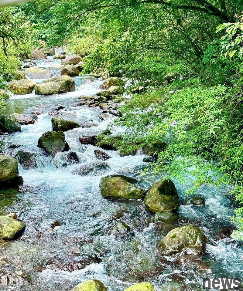
Along the way, I admire the charming natural scenery of huge rocks and streams. I often see animals such as monkeys, civets, squirrels, mountain brides, bamboo chickens, etc., butterflies, dragonflies, and damselflies shuttle through the forest, mainly planted with hot belt plants such as Changnan Secondary Forest and Jiuxiong Forest.
Because of tightening Song Luo River, you can always feel the refreshing and moist water tide when you walk.
The 2-kilometer Songro National Trail is equipped with a mileage indicator every 100 meters. Being in this primeval forest is like walking into another fairyland, hearing the gurgling water sounds and the green world, and sucking in a lot of Fendo essence and ion. Although the trail is long, it makes people feel more and more happy!
The comfortable and comfortable Song Luo National Trail has rich natural scenery and is not as colorful as many people. The simple Guizhuhong Bridge, cable hanging bridge, rest pavilion, wooden road and other facilities retain the environmental characteristics.
Some sections of the road are stone roads and there are a few stairs. Because the local humidity is heavy, most of the stones are covered with moss, reminding the public to pay attention to the situation of their feet when walking. The hairdressers should walk with a mountaineering stick to avoid slipping.
Songro National Trail is a breeding place for bitter fish. The Taya people called bitter fish "kole-balai", which means "real fish". The Japanese paid it the name "high mountain fish". In the past, affected by forest debris and ecological damage, the number of bitter fish once decreased.
After 2002, the Songro Community promoted the Fengxi Rehabilitation Plan and achieved success. At present, a large group of bitter fish can be seen gathering in the rest area about 500 meters in front of the control station and in several pools on the Songro Trail.
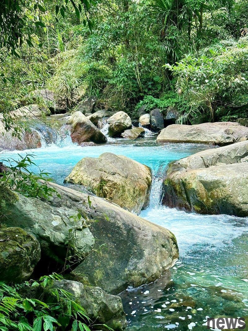
Walk to the end of the trail and arrive at the boulder area upstream of the Songro Creek.
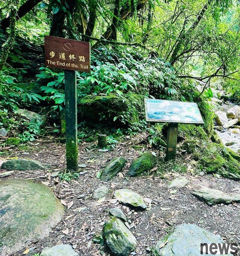
The stream flows through it, forming several small waterfalls. It is suitable for finding a flat and spacious stone head and sitting on it with a towel.
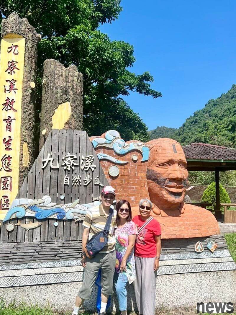
Yilan Datong Songro National Trail
Drink water and rest on the side, and listen to the sound of nature's horns and flowing water. It is also suitable for picnics here to enjoy the scenery, and you can see the clear emerald water in front of you. This fairyland can be regarded as a human enjoyment.
Visit the secret realm of the Tayya tribe! The trail is easy to walk on the waterfall, and the flowing waterfall from the snowy mountains
【Full introduction】https://egoldenyears.com/73696/
The most beautiful and peaceful city is in Taipingshan, Yilan! Internationally certified the world's first Ningjing Trail with only 25 points: Cuifeng Lake, CNN certified one of the most beautiful trails in the world: See the ancient trail
[Full introduction] https://egoldenyears.com/71843/
. 3 Friendly Trails in North, Central and South
(Responsible editor: Ye Zicen)